As the temperatures begin to decline after the intense Summer heat waves, the allure of outdoor activities grows more enticing.
One of the more enchanting ways to explore nature is through hiking. To aid your outdoor pursuits, we have curated a selection of notable hiking options within the region. Our compilation spotlights Niseko's trails, catering to both families seeking relaxed ambles and thrill-seekers in search of adventure.
Walking Trails and Parks
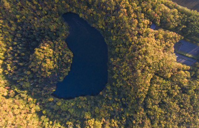
Kagami-numa
The term "Kagami," signifying 'mirror' in Japanese, aptly describes the pristine waters of the natural pond nestled in the wetland marsh just below Mount Annupuri.
This hike has a 570-meter elevation gain and takes approximately 45 minutes. The slope's gradient remains mostly gentle but becomes notably steeper in the final 5 minutes of the ascent. Spot silver birches, Japanese maple trees, and blue or red dragonflies along the trail, which leads to the mirrored surface of the pond reflecting Mount Annupuri.
Location: Google Maps
Shinsen-numa
“This is the place where Gods and immortals exist” - Toyomatsu Shimoda on the Niseko Range (co-founder of the Boy Scouts in Japan).
His words encapsulate the naming of the marsh as Shinsen-numa (with "Shinsen" signifying 'God and immortals,' and "numa" meaning 'marsh' in Japanese).
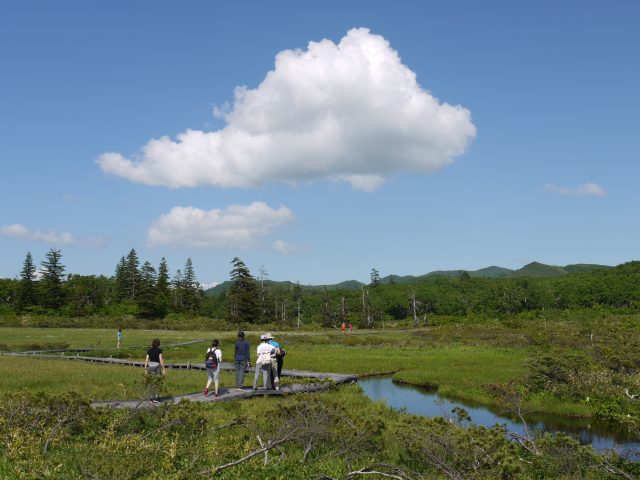
The natural wonders of Shinsen-numa are accessible via wooden footpaths, making it a perfect outing for the entire family, from young children to the elderly. The trail is adorned with various ponds, each showcasing unique reflections of their environment.
Location: Google Maps
Lake Hangetsu
Hangetsu means ‘half moon’ in Japanese, which is reflected by the shape of the lake. Lose yourself amidst the grand oak trees and wild flora, with local fauna like woodpeckers and chipmunks enhancing the woodland experience.
With an elevation gain of 111 metres, the trail consists of a 3.1 km loop and a footpath that leads to the lakeshore. It takes approximately 15 to 20 minutes to reach the lakeside and around 55 minutes to complete the full loop. Although mellow, we recommend wearing sturdy shoes, especially after rainfall as it gets slippery.
Location: Google Maps
Find out more: AllTrails
Asahigaoka Park
Ideal for picnics, Asahigaoka Park is also equipped with campgrounds and playgrounds, making it a perfect haven for families to enjoy together. A well-maintained footpath goes to the top of the former ski jump, allowing even small children to take in views.
Location: Google Maps
Hiking Trails
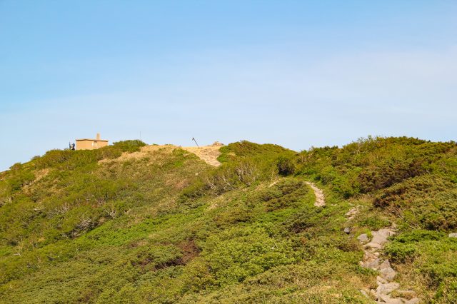
Chisenupuri
Chisenupuri's name is derived from "chise-nupuri," meaning 'house[shaped] mountain' in the Ainu language, reflecting the mountain's resemblance to traditional Ainu sasa bamboo and reed-thatched homes.
Chisenupuri has two entrances, but we recommend commencing from the Shinsen-numa marsh entrance on the Niseko Panorama Line. Upon reaching the summit, take in the awe-inspiring views of neighboring peaks, including Mount Mekunnuai-dake and Shakunage-dake.
Location: Google Maps
Find out more: Mountains of Hokkaido
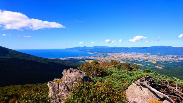
Iwaonupuri
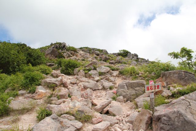
Iwaonupuri draws its name from the Ainu term "iwao-nupuri," translating to 'sulphur mountain’, as volcanic ash and yellow sulphuric crystals are scattered across its slopes. The hike spans 4.8 km with a 350 m elevation gain, typically taking around 2 hours to complete.
While traversing the horseshoe-shaped crater at the summit, you'll enjoy the diversity of Hokkaido's landscape. The trailhead is situated at Goshiki Onsen, which features an outdoor bath offering a relaxing treat after the hike.
Location: Google Maps
Find out more: AllTrails, Mountains of Hokkaido
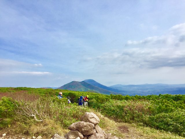
Niseko-Annupuri
Mount Niseko Annupuri stands as one of the main ski resorts in Niseko and is considered the pinnacle of the Niseko volcanic group. Recognized for its moderate challenge, this 5 km hike typically takes around 2 hours and 46 minutes to complete.
Since the trailhead is also located at Goshiki Onsen, you can unwind in the outdoor baths after soaking in the beauty of Niseko's summit.
Location: Google Maps
Find out more: AllTrails
Mount Yotei: Makkari trail
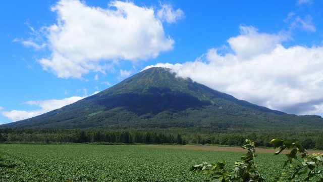
Mount Yotei is impossible to miss during a visit to Niseko. As the most prominent stratovolcano in the region, boasting an elevation of 1,898 meters, it has earned the nickname Ezo Fuji due to its resemblance to Mount Fuji.
The Makkari Trail is possibly the least technically demanding of the four routes leading to the summit. Despite its reputation for challenge, it remains a popular hiking choice, spanning 13.7 km and requiring an average of 7 hours and 48 minutes to complete.
Reaching the summit brings its own reward: unique viewpoints from the elliptical crater, set amidst an environment rich with alpine plants and wildlife.
Location: Google Maps
Find out more: AllTrails, Hikes in Japan, Mountains of Hokkaido
Shirakabayama
With an altitude of 959 meters, Shirakabayama stands as a minor peak in the Niseko range, offering a relatively straightforward ascent. Typically, the climb to the summit and back takes around 2.5 hours. The trailhead is located at Niimi Pass, between Ranpetsu and Kyowa Town.
Location: Google Maps